The Doolin Cliff Walk is an 8km hike from the beautiful village of Doolin to the top of the Cliffs of Moher. It’s one of our favorite hikes in Ireland and, as well as the incredible views of the Clare Coastline, it is a really unique way to experience the Cliffs of Moher.
We’ve hiked the Doolin Cliff Walk a number of times and have put together this guide to help you plan your Doolin Cliff walk: it includes where to park, what to pack, and everything you need to know about the route itself. We hope you have as much fun on this stunning hike as we have had.
The Doolin Cliff Walk
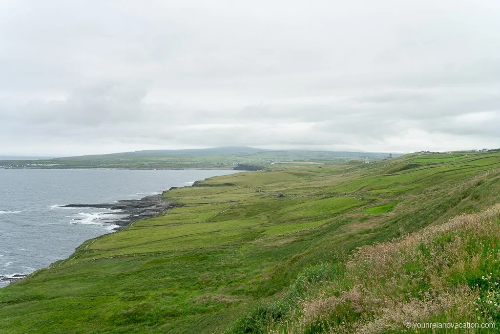
The Doolin Cliff Walk starts in the Village of Doolin and is an 8km hike along the coastal cliffs up to the Cliffs of Moher. The route takes around 3 hours each way and is a wonderful mix of ocean and lush green landscapes coupled with breathtaking views of the cliffs. The Doolin Cliff Walk is one of the best things to do in Doolin and one of our favorite things to do in Clare.
If you prefer a one-way hike there is a bus service from the Cliffs of Moher Visitors Center that transports hikers back down to Doolin.
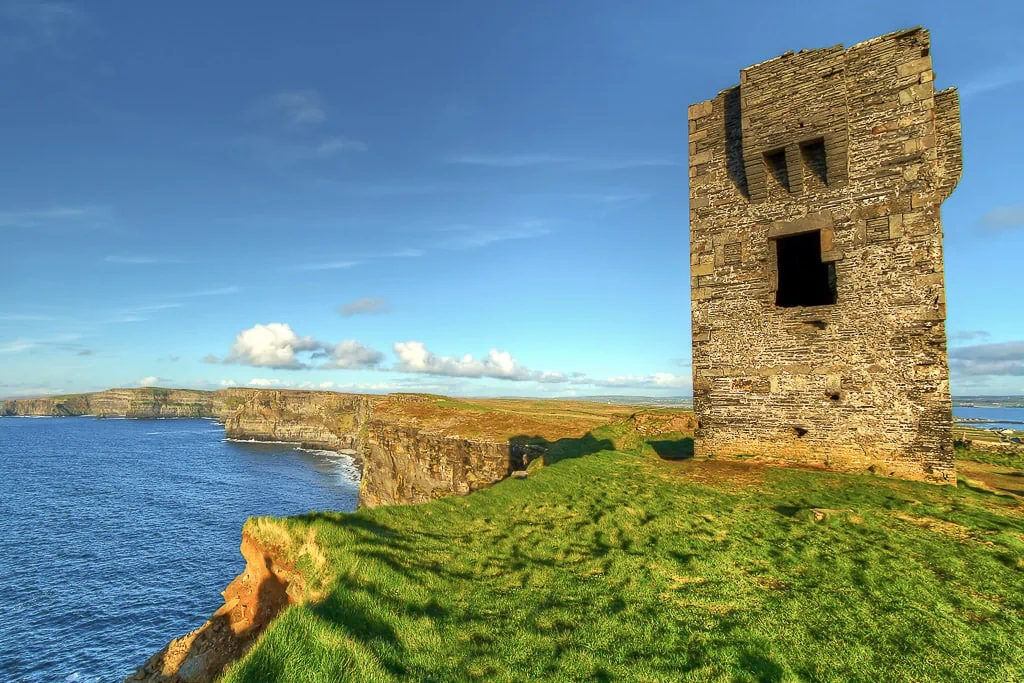
Doolin Cliff Walk tip: when you reach the Visitors Center you can continue your hike to Hag’s Head, the most southerly point of the Cliffs of Moher. The hike is an additional 4.5km each way from the Visitors Center to Hag’s Head – it’s a wonderful hike on a relatively flat trail and you will reach the stone ruins of an old watchtower, Moher Tower, at Hag’s Head.
Doolin Cliff Walk Trail Difficulty
A reasonable leave of fitness is required for the Doolin Cliff. The trail is relatively flat with some gradual inclines and a few steep climbs. However, the gravel trail can be uneven at times and the trail is exposed to steep drops on the cliff edges so you need to be comfortable with this and take extreme care.
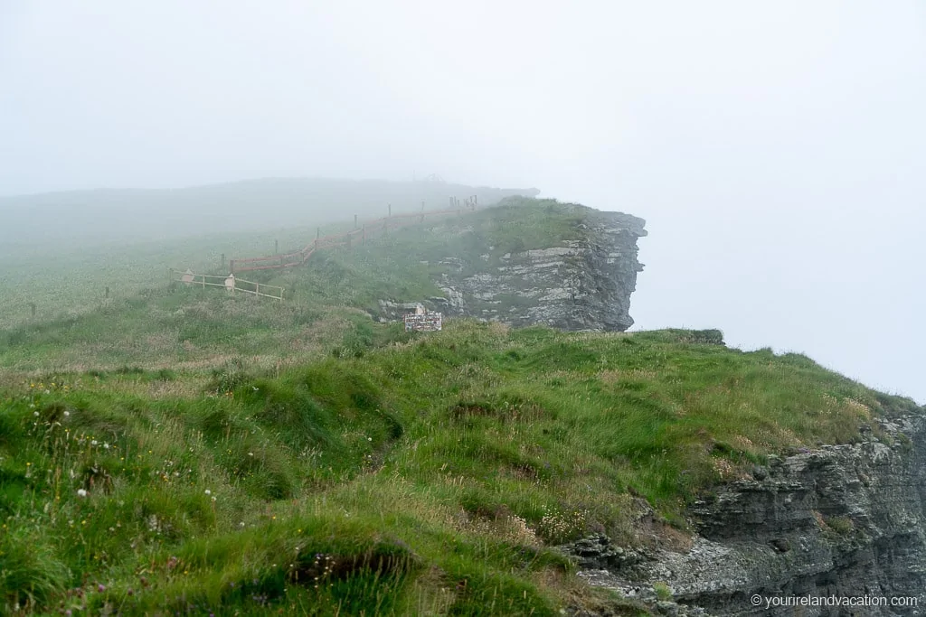
Doolin Cliff Walk tip: the trail is not suitable for younger children or dogs and should be avoided in high winds or foggy conditions.
Doolin Cliff Walk Parking
There are a few parking spots in Doolin that are convenient for the Doolin Cliff Walk:
- Fisher Street: Doolin’s main street
- Cliffs of Moher Park and Ride Car Park: close to Garrihy’s Cross in Doolin, this is a good choice if you plan to hike one way and take the bus back to Doolin
- Russell Community Centre: north of the village
Doolin Cliff Walk: Trailhead
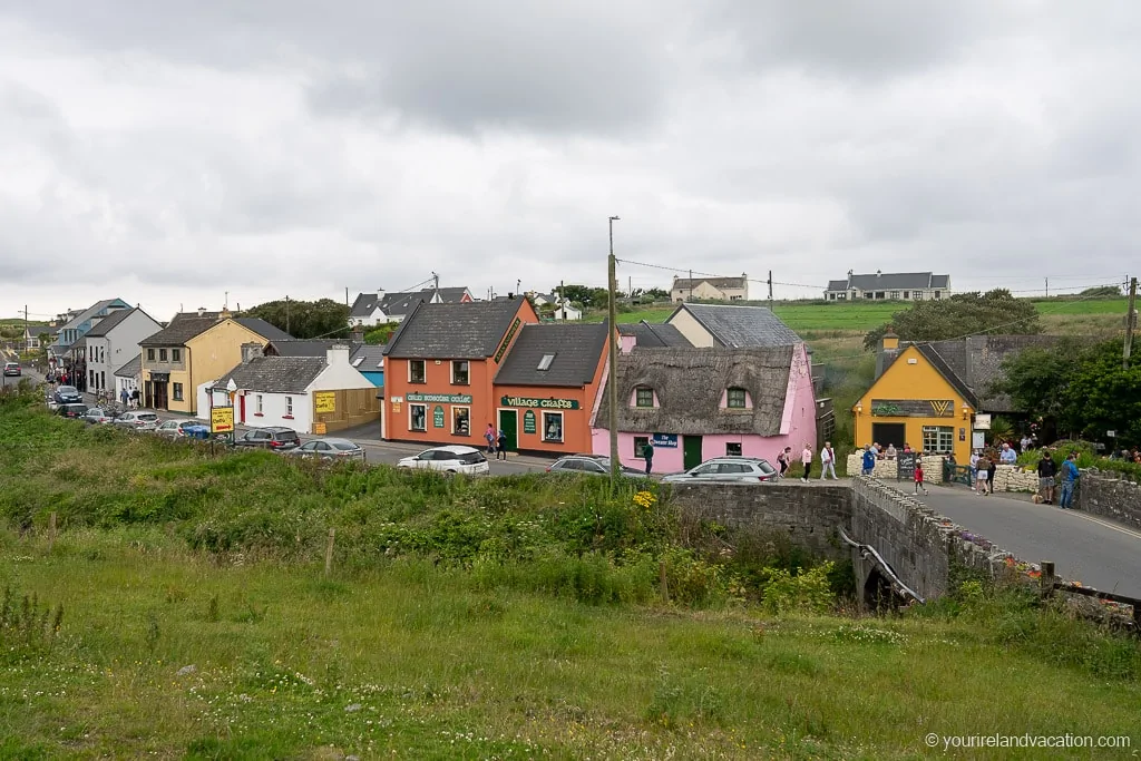
After parking your car, make your way towards Sea View House and then Castle View House, where the Doolin Cliff Walk trail begins.
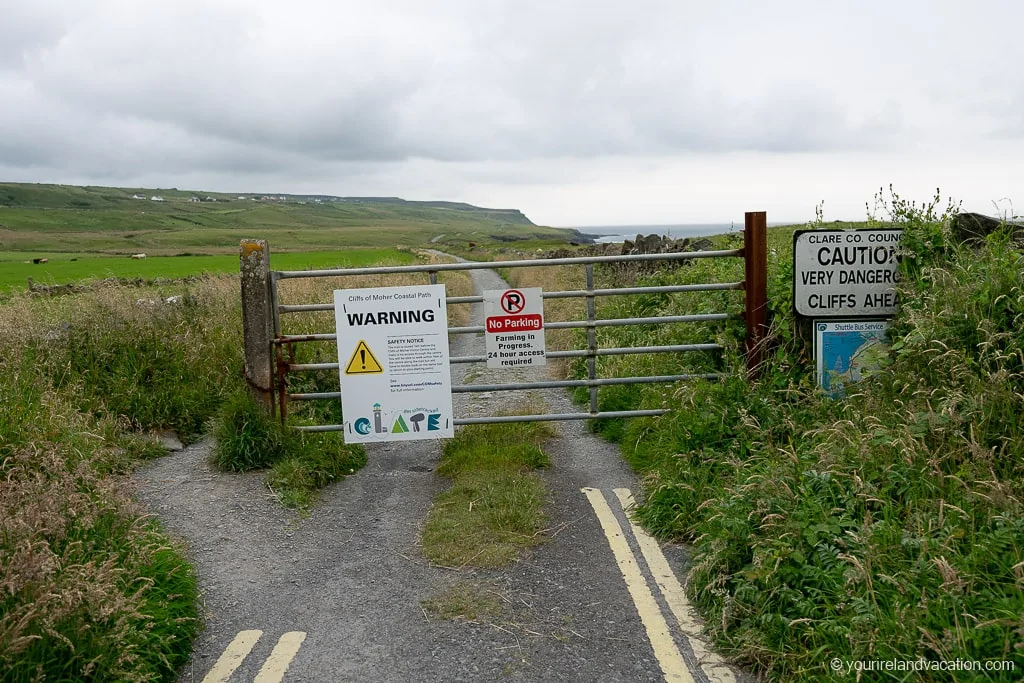
Doolin Cliff Walk tip: there is no parking at the trailhead and there are signs asking visitors not to park/block access to the trail. The access route is vehicle access for the local landowners and farmers only
The Doolin Cliff Walk Trail
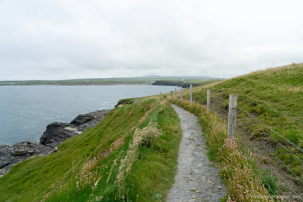
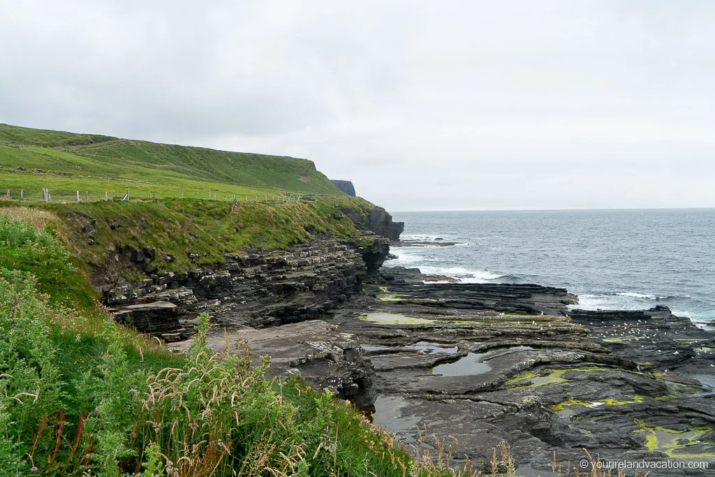
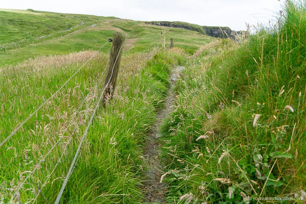
The first section of that trail is a rough gravel path that leads up the coast. The cliff edge along this section is not marked so care is needed if you follow any of the unmarked tracks to the edge.
Doolin Cliff Walk tip: The hike route is part of the Burren Way hiking trail, a 120 km, 5 day, hiking trail that runs from coastal town of Lahinch up to the Burren and back down to the town of Corofin.
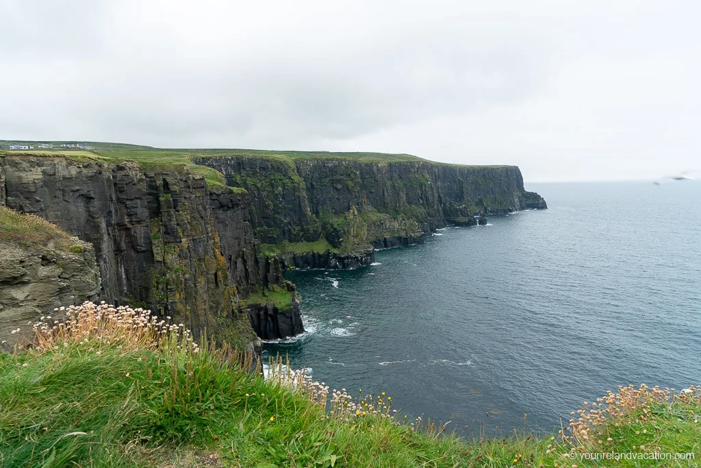
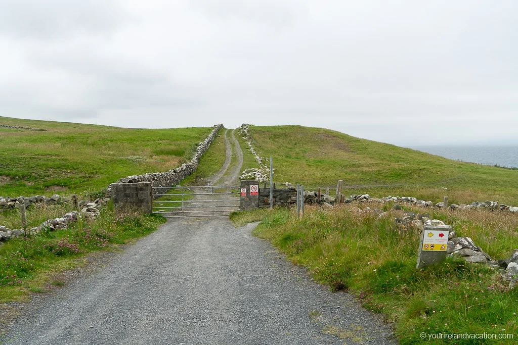
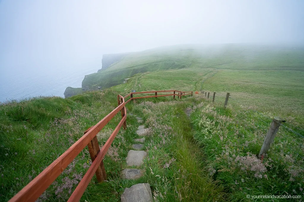
The trail leaves the gravel road via a turnstile after around half a kilometer and starts to snake along the cliffs on a well-marked and maintained gravel trail. The views become a lot more impressive on this section as the trail hugs the cliffs.
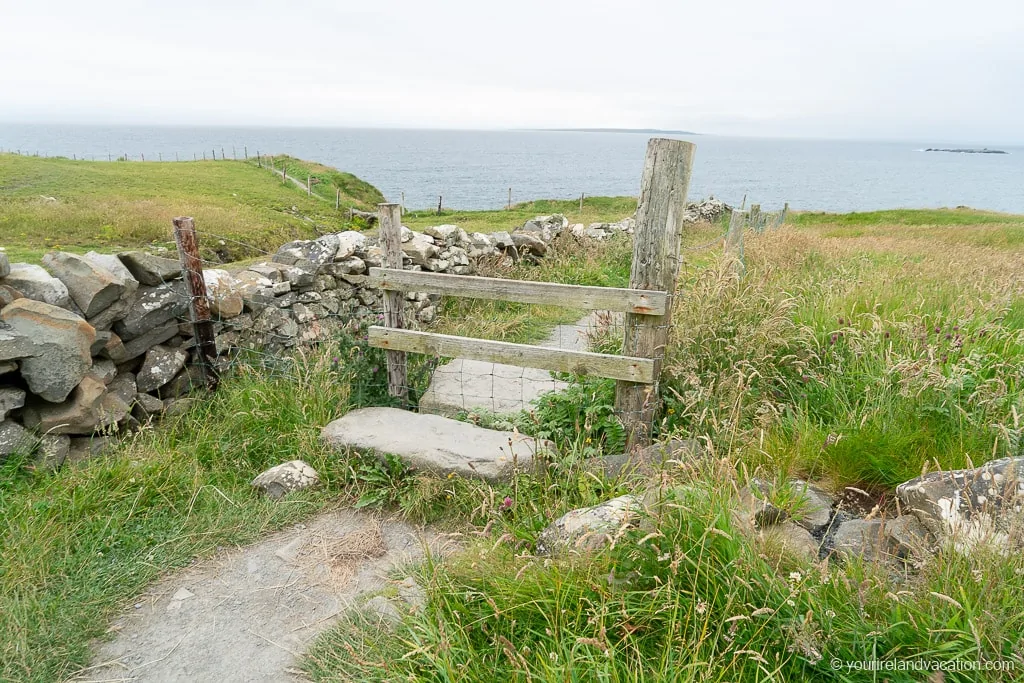
The gravel path is very easy to follow and we’d recommend staying on it all times on this section of the trail. There are lots of hidden cliff edges and high drops located just a few meters from the trail so be sure not to stray from the trail – there are lots of awesome viewpoints along the trail without having to step off the gravel.
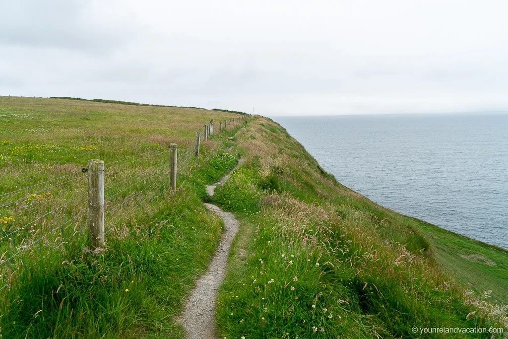
Doolin Cliff Walk tip: Be careful not to touch the electric fences that line the perimeter of the farmland fences. They are generally located on the inside of the fence (there’s another protective wire on the trail side) and you can identify them by the rubber connectors at the fenceposts. They’ll give you an unwelcome shock if you accidentally touch them!
After following the cliff trail for a few hundred meters, it takes a sharp left turn that leads up the hill and away from the cliffs. It might seem like the trail should continue on along the cliffs, however, this is an old route that is no longer in use and is now part of the privately owned field.
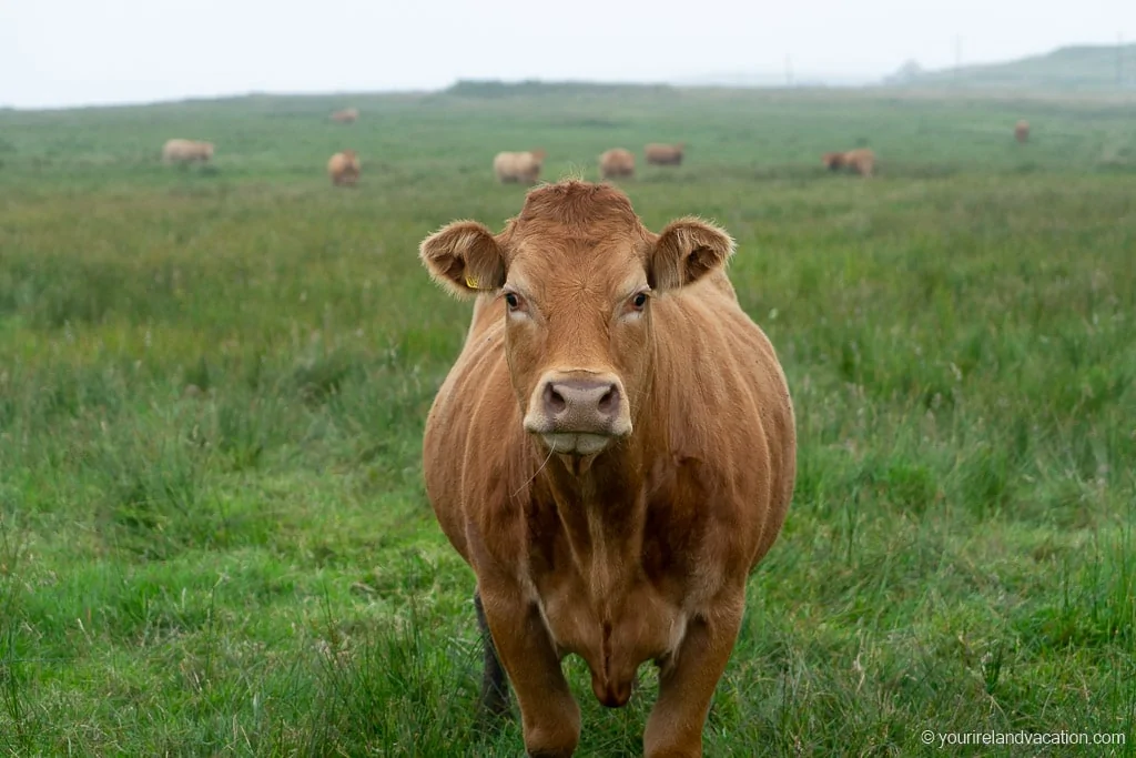
After this turn, the trail starts the ascent up to the Cliffs of Moher. A short distance after leaving the cliffs the trail crosses into active farmland. There is a turnstile marking this and advises hikers to keep to the stone wall on the right of the field. At the end of the stone wall, there is a shed and an exit to the rest of the trail.
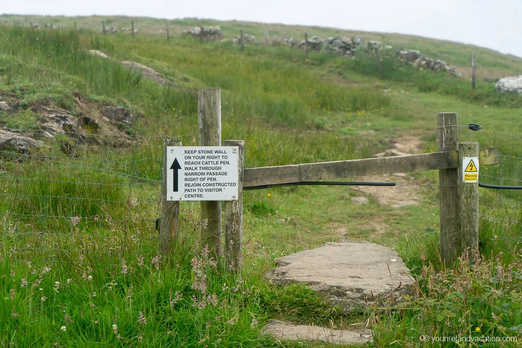
Doolin Cliff Walk tip: Always be aware of where animals are in a field when you are hiking through it. Although livestock is generally very calm and inquisitive, they are large animals and can hurt you!
After leaving the farmland the trail continues through a small gate and turns back towards the cliffs. As the trail approaches the cliff the route turns left and leads up a steep section to the entrance to the Cliffs of Moher Visitors Center.
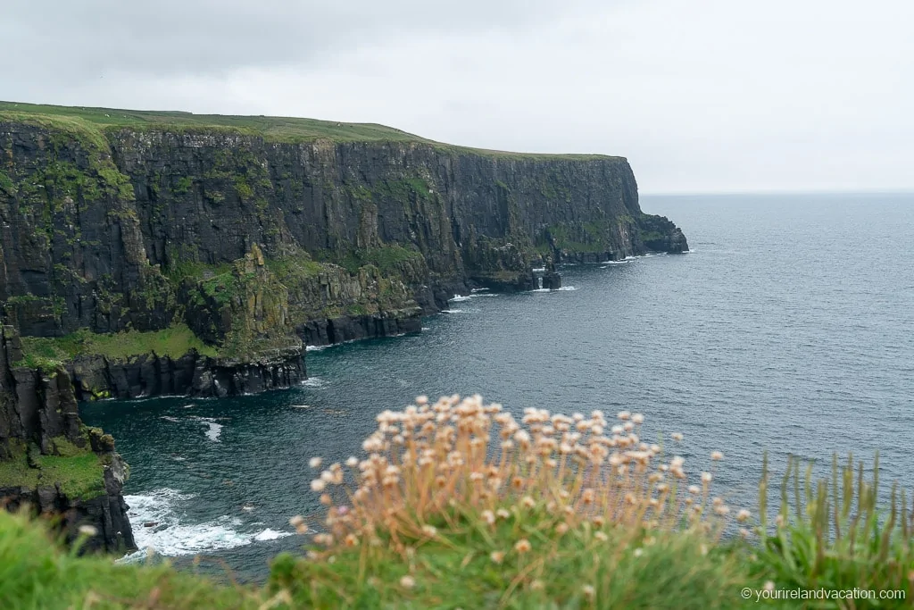
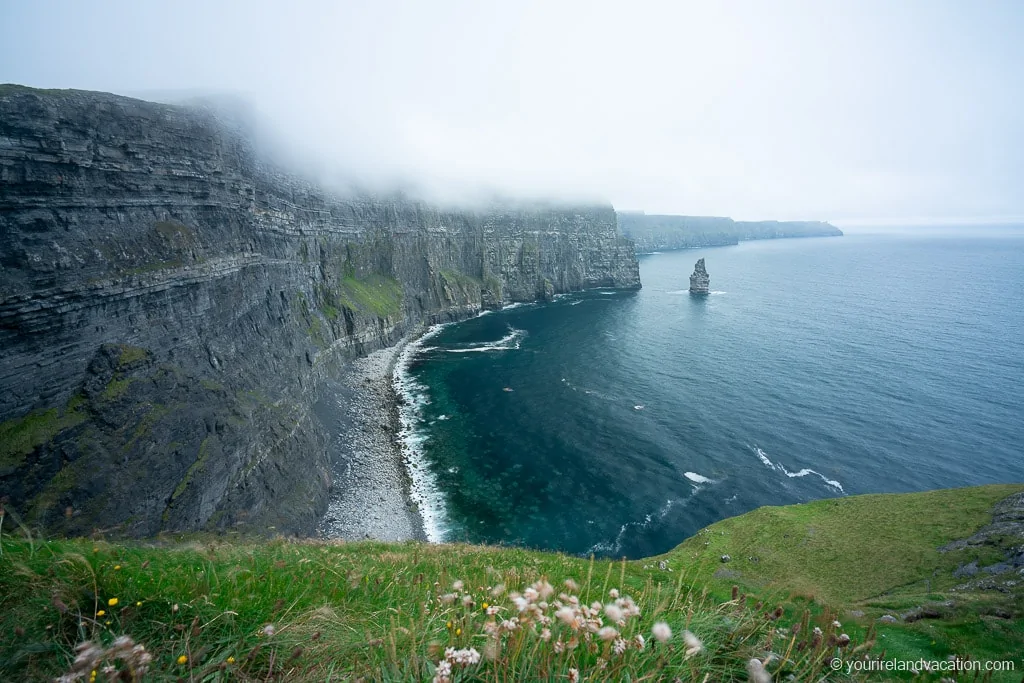
Doolin Cliff Walk tip: Before climbing up the hill to the Cliffs of Moher there is an excellent viewpoint located a short distance from the trail. The viewpoints is part of the old route along the coastal cliffs back towards Doolin, however it is accessible to the public and not on private lands.
The viewpoint is unique as it sits below the summit of the cliffs and has incredible views of the Cliffs of Moher and O’Briens Tower.
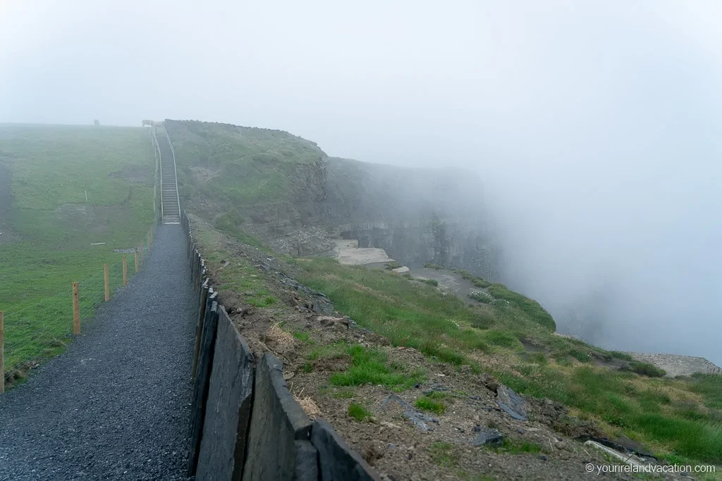
The final section of the Doolin Cliff walk up to the Cliffs of Moher Visitors Center has been upgraded in recent years. Prior to the upgrade, the trail was rough and the cliff edge was exposed along most of this section of the trail.
The trail is now well maintained, with a wooden fence along the steepest section of the final ascent.
Cliffs of Moher Visitor Center on the Doolin Cliff Walk
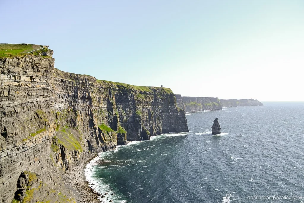
Once you reach the summit of the Cliffs of Moher there is a wide gravel path with a large slate/stone wall protecting hikers from the cliff edge.
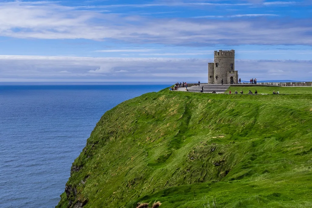
From here it’s a flat walk to O’Brien’s Tower, the highest point on the Cliffs of Moher and the main viewing area for the cliffs. From here, there are incredible views south towards Hags Head and north towards Doolin.
Extending the Doolin Cliff Walk to Hag’s Head
For those who want to experience even more epic views of the Cliffs of Moher, you can continue along the path to Hag’s Head which is located around 4.5km south of O’Brien’s Tower. Hag’s Head is the location of Moher Tower, the stone ruins of an old watchtower, and the views are magnificent on a clear day.

Returning to Doolin
There are two options for the return trip to Doolin: you can either take the shuttle bus from the Cliffs of Moher Visitor Centre to Doolin or hike back along the Doolin Cliff Walk. If you’re tired from the hike up to the Visitors Center then hop on the bus back down!
Doolin Cliff Walk Route Map
We’ve put together a Google Map to help you plan your hike to the Cliffs of Moher
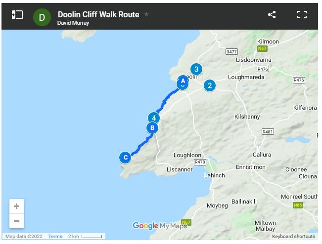
How to Use This Google Map: Click on the grey star at the top of the map and this map will be added to your Google Maps account. You can then view it on your phone or computer in Google Maps by clicking on the menu button, going to “Your Places” and selecting this map. We use these maps all the time as you can set out your itinerary ahead of time and quickly reference the saved maps
FAQ and Tips for the Doolin Cliff Walk
Some of the most common questions we get asked about the Doolin Cliff Walk:
1 | Where is the Doolin Cliff Walk?
As the name suggests the Doolin Cliff Walk starts in the village of Doolin in Co. Clare and snakes along the coastal path up to the Cliffs of Moher.
2 | Do I need hiking boots?
While you can do the Doolin Cliff Walk in regular trainers/shoes we’d recommend wearing hiking boots or trail runners for the hike for extra grip and comfort.
3 | How long is the Doolin Cliff Walk?
Although referred to as the Doolin Cliff Walk, the route is definitely a hike. The route follows the coastal cliffs from Doolin village to the start of the Cliffs of Moher Visitors Center.
The hike along the cliffs is 8km each way with an elevation gain of around 160 meters so you’ll need to be relatively fit.
If you take the road route back to Doolin you’ll shave around 1km off this distance but the views are not as nice.
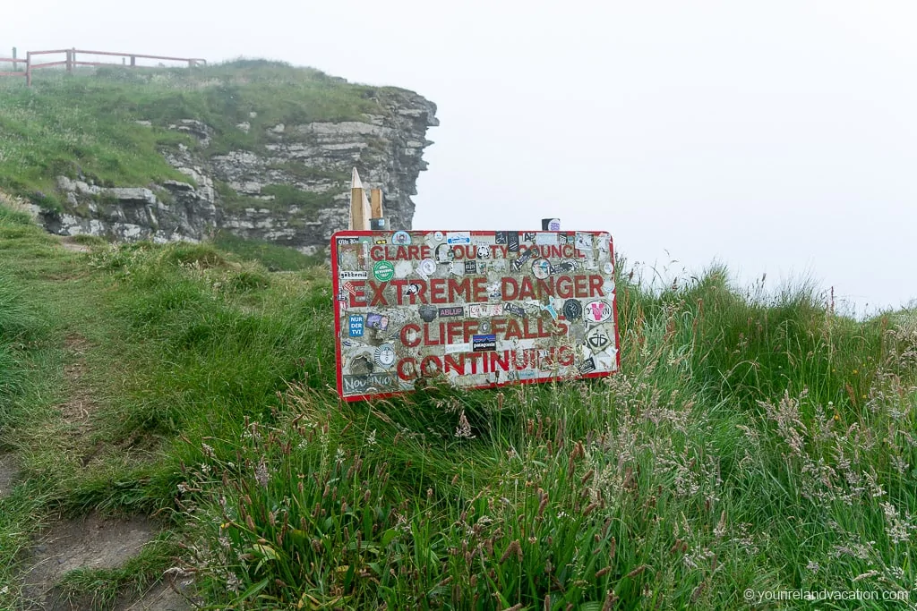
4 | Is the Doolin Cliff Walk Dangerous?
Yes and No.
While the trail is well marked there are sections that pass very close to the cliffs with high drops so you do need to take extreme care. Due to this, the trail is not safe for young children or dogs.
While the trail is clearly marked and is located well back from the edge of the cliffs it can be very tempting to step off the trail for better views of the cliffs – don’t do this. Once you step off the marked trail there are some very high drops off the cliffs to the rocks and ocean below.
There is also a short section of the route which crosses active farmland with cattle, so anyone who is not comfortable with animals may not like this section of the route!
5 | Are dogs allowed on the Doolin Cliff Walk?
Unfortunately, no dogs are allowed on the trail as parts of the trail are across active farmland and most of the trail is right alongside active farmland.
6 | Check the weather forecast
Weather conditions can change very quickly along the coast at the Cliffs of Moher so it’s extremely important to check the weather forecast before planning the Doolin Cliff Walk. The two most dangerous conditions are high winds and fog which can make the hike extremely dangerous due to the close proximity to the cliffs. If either of these conditions are forecast it’s highly recommended not to attempt the hike.
7 | Where is Parking for the Doolin Cliff Walk?
The trailhead to the Doolin Cliff walk is actually located around 700 meters up the hill from Doolin village. There is no parking available at the actual trailhead (it’s simply a gated entrance located on the road) so you’ll need to park in Doolin Village and walk up the hill to the start of the trail. We parked on the main street (Fisher Street) just up from Gus O’Connor’s Pub.
8 | What do I need to take on the Doolin Cliff Walk?
Bring water, your phone (with route map), and snacks. Depending on the weather bring layers, rain gear, and SPF.